Today, I’m taking you through the rugged trails and breathtaking vistas of Glacier Park to explore the beauty of our State Parks and Wilderness Areas. If you’re a seasoned hiker or just starting, you’ll love this because I’ve got some tips, tales, and experiences to share. So lace up those boots, grab your water bottle, and let’s hit the trail together!
Exploring the Wilderness
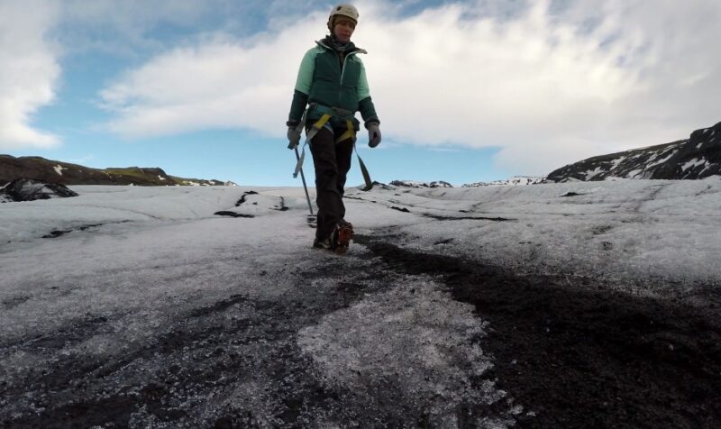
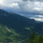
Glacier National Park
Glacier National Park truly lives up to the hype. Driving the Going-to-the-Sun Road was an absolute highlight; imagine cruising along a 50-mile stretch that’s wrapped into the mountainside, with every twist and turn revealing views that look straight out of a postcard.
At its peak, the road sits over 6600 feet up, giving you a bird’s-eye view of valleys and rugged peaks that words just can’t do justice. You’ll want to stop at every lookout, trust me.
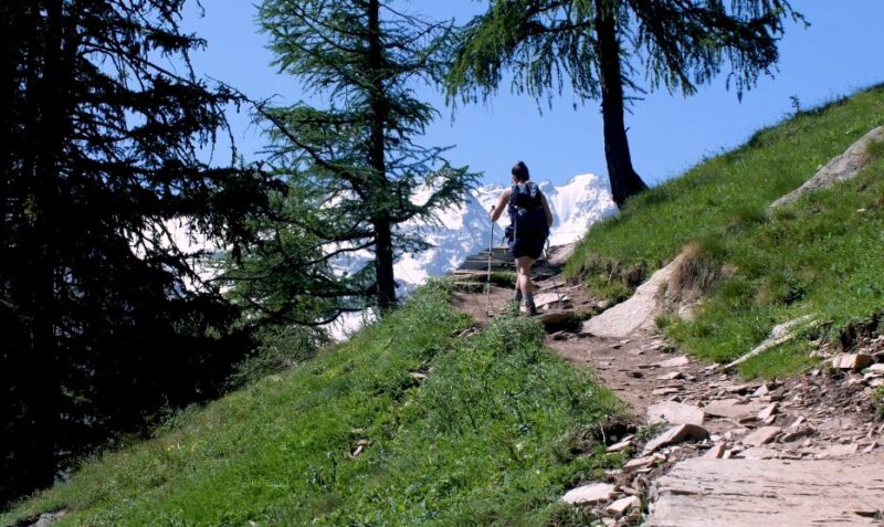
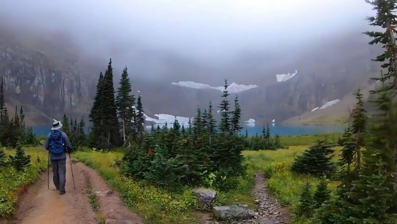
There Are Trails for Every Hiker
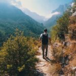
Glacier National Park offers more than 700 miles of trails, among which you are bound to find the one that suits your skill level. For beginners, I recommend the Trail of the Cedars—an easy, flat, wheelchair-accessible loop through the forest and the Avalanche Gorge.
For the more experienced, I suggest you hit the Highline Trail, starting at Logan Pass. This is an adrenaline-filled trek along narrow ledges with steep drop-offs, which culminates in a gorgeous panoramic vista.
This was my fourth visit, and I still haven’t ticked off all the trails. That’s the beauty of it – there’s always a reason to come back. Speaking of which, I’m already mapping out the next couple of trips. Can’t get enough of this place!
Here are all the available trails:
- Grinnell Glacier Trail: An 8-mile round trip that takes you through verdant meadows to the magnificent Grinnell Glacier, showcasing the park’s stunning glaciation and turquoise-hued lakes.
A note from National Park Service: “The alpine section of the Going-to-the-Sun Road is closed for the season. The road remains open to Lake McDonald Lodge on the west side and to St. Mary Campground on the east side.”
- Iceberg Lake Trail: A moderately challenging 9.7-mile journey leading to Iceberg Lake, where floating icebergs create a surreal landscape against the backdrop of towering peaks.
- Hidden Lake Overlook Trail: A shorter, 2.7-mile round trip offering stunning views of Hidden Lake, perfect for those with limited hiking expertise or seeking a less strenuous adventure.
- Siyeh Pass Trail: For the seasoned hiker, this 10.3-mile loop rewards with breathtaking panoramas of Sexton Glacier and surrounding jagged peaks, offering a sense of accomplishment and awe.
- Avalanche Lake Trail: A family-friendly 4.5-mile trek through old-growth forests to the stunning Avalanche Lake, surrounded by soaring cliffs and waterfalls.
- Swiftcurrent Pass Trail: A 13.2-mile journey through vibrant wildflower meadows, alongside pristine lakes, and abundant wildlife, offering a taste of Glacier’s diverse ecosystems.
- Piegan Pass Trail: This 9.6-mile hike provides spectacular vistas of the mountains and valleys, with opportunities to spot wildlife such as bears and golden eagles.
- Two Medicine Lake Trail: A serene 7.8-mile loop around Two Medicine Lake, offering a tranquil experience in one of the park’s less crowded areas.
- Gunsight Pass Trail: A challenging 20.4-mile hike that crosses diverse terrain, offering incredible vistas of Lake Ellen Wilson and Gunsight Glacier, for those seeking solitude and adventure.
Wildlife Watching
Aside from the scenic beauty, I had a few mild encounters with wildlife. I saw some mountain goats from far, but luckily, I did not run into predatory grizzlies. They may be interesting to observe, but only on TV or in a zoo.
If you’re lucky, you might encounter some beavers and pikas as well, but stay on the marked roads when hiking, because there ARE coyotes, although they are rare, especially in the eastern part of GNP.
The Weather and Best Times to Hike
Glacier National Park is open all year round, but I recommend hiking from July to September. During this time, most of the trails are snow-free, and the Going-to-the-Sun Road, the park’s main thoroughfare, is fully open. Remember, the park’s high elevation means you will get exposed to chilly weather, even in summer, so come prepared with appropriate clothing.
A look at the average weather conditions over the year is the best way to plan the right moment for your adventure.
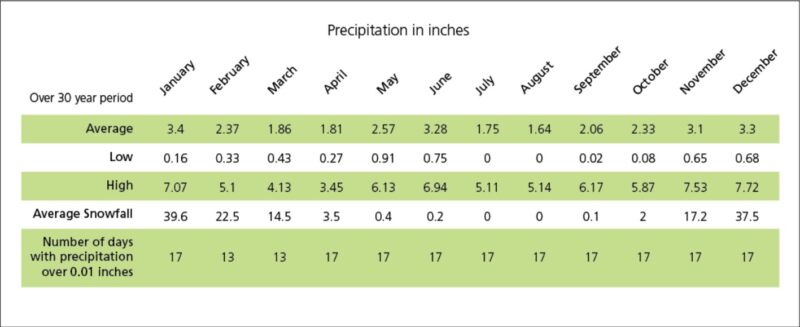
source: https://www.nps.gov/glac/planyourvisit/weather.htm
State Parks
When it comes to state parks, each season brings its unique charm. The Colorado State Parks, for instance, transform with the seasons. Visit the Eldorado Canyon State Park in spring to see wildflowers in full bloom. Summer in Mueller State Park is perfect for hiking under the warm sun, while Eleven Mile State Park in winter turns into an ice fishing paradise.
How Difficult Is It?
Hiking in Glacier Park, state parks, and wilderness areas requires varying levels of fitness, depending on the trails you choose.
The park hosts a range of trails, from easy, flat walks suitable for the whole family, to difficult hikes that ascend high into the mountains. If you plan to take on challenging trails, regular cardio exercise and strength training for a few weeks prior will be beneficial.
I exercise regularly, so I rarely find issues with a bit more challenging trails, but if you don’t have such habits, I suggest you prepare.
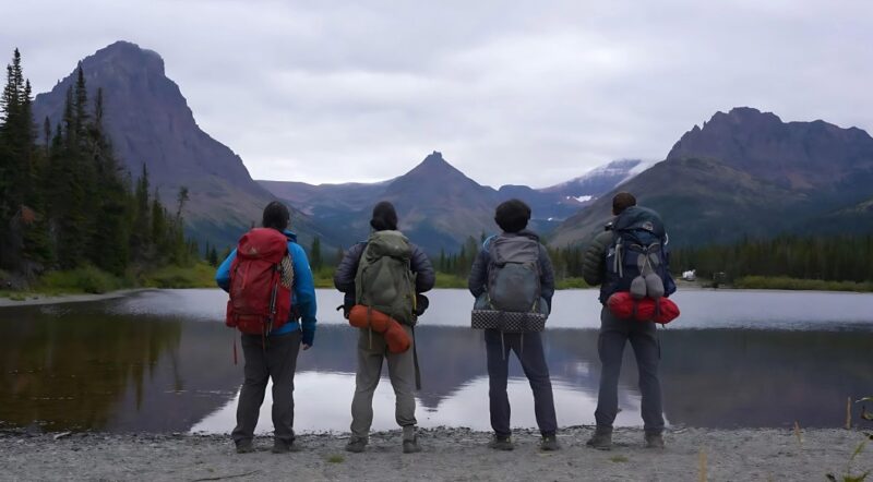
Tips for Hiking in These Areas
I’ve spent my fair share of time trekking through Glacier Park and various state parks, and now I want to share some wisdom about hiking with you. Here are my tips to make your journey more enjoyable and a tad easier. Trust me, I learned some of these the hard way.
Overpacking Water Is Unnecessary
Most trails in Glacier Park have plenty of water sources. Before you head out, just double-check your map. For short hikes, a water bottle with a built-in filter can be very useful. It’s light, super handy, and all you gotta do is dunk and drink.
Lighten Your Load
Packing light is the mantra. I stick to the essentials based on the season and my plan. My go-to items include a water filter, a cozy puffer jacket, my trusty camera, an extra pair of socks (because you never know), moleskin for blisters, a rain jacket, a headlamp, and, of course, a lighter and matches tucked away in a plastic bag.
And snacks – don’t forget the snacks! A mix of protein bars, jerky, nuts, and some chocolate for a quick energy boost. Also, a side note: on longer treks, I even cut my toothbrush in half to save on weight. Every little bit helps!
Timing is Everything
The timing of your start can make or break your hike. Aim for first light, especially during the busy months of July and August. Beat the crowds to fully enjoy what nature has to offer. Trails like Avalanche Lake and Grinnell Glacier are popular for a reason but much more enjoyable in the peaceful early hours.
Dress Smart, Not Cotton
The old saying “hike naked” threw me off at first, but it’s all about fabric choice. Ditch the cotton and go for moisture-wicking materials like wool or poly blends. Layer up so you can easily adjust to the changing weather, which can be pretty unpredictable in Glacier. And yes, this applies to socks too!
Forget About Calling Home… Kinda
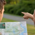
With so many tech and gadgets available nowadays, it’s tempting to rely on your phone for everything. But out here, it’s best to kick it old school with a paper map and compass. Glacier’s wild beauty deserves your full attention, and your phone’s battery is better saved for emergency photos. Just make sure someone knows your plans before you disconnect.
Solo Hiking? Think Twice
The thrill of hiking solo is unmatched, as it offers a unique connection with nature. Yet, Glacier is known for its wildlife, including grizzlies. While I love the solitude, I also respect the advice of guides and always carry bear spray.
If you decide to go it alone, stay alert, especially in dense vegetation or near blind corners. But honestly, having a buddy is not only safer but can also offer a better experience.
Choose Your Boots Wisely
A seemingly odd tip, but getting hiking boots half a size larger can save your toes. Swelling is a real thing, and snug boots today might mean blisters tomorrow. And please, break them in before you hit the trail. Your feet (and fellow hikers) will thank you.
Belt Blues
Ever start a hike feeling great, only to be annoyed by a belt digging into your hip? Ditch the bulky belt for something more backpack-friendly. A slim, nylon belt can prevent those irritating hotspots and keep your focus on the beauty around you, not the pain.
Final Words
To wrap up this guide, I just want to share one last nugget of wisdom: embrace the adventure, but respect the journey. The tips I outlined, from lightening your pack to choosing the right gear, are tiny gems I’ve mined from countless trails, missteps, and endless trial and error, so consider them before setting off. Good luck, and don’t forget to have fun!
I’m Noel Massey, your not-so-typical trailblazer who’s been into hiking for years while herding two mini adventurers, a.k.a. my sons. We’ve tackled trails that would make your GPS do a double-take. Join me as I share tales from the great outdoors, and share some handy tips you could use in the future.