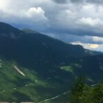
The Bob Marshall Wilderness Complex stretches across a wild swath of northwestern Montana where silence still outweighs signal, and distance reshapes time. Locals call it simply “the Bob,” a name that captures both affection and respect.
The scale is hard to grasp until you see it on a map: more than 1.5 million acres across the Bob Marshall, Great Bear, and Scapegoat Wilderness Areas. The Continental Divide slices through its heart.
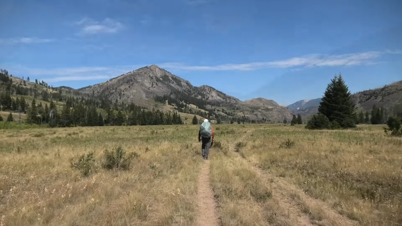
Over 3,200 miles of trail, much of it primitive, weave through deep valleys, alpine passes, and river corridors that test judgment as much as endurance.
For hikers with solid backcountry mileage, the Bob represents one of the last places in the Lower 48 where you can disappear into genuine wilderness and still come back with a sense of coherence rather than chaos.
The goal here is not to conquer anything but to move intelligently through it, knowing which details matter most: access, regulations, hazards, and routes that still feel personal.
The Shape and Scale of the Bob
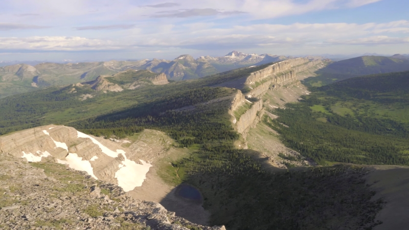
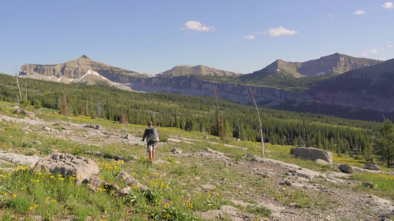
The Bob’s terrain unfolds between 5,000-foot valleys and ridgelines that rise above 9,000 feet. Between those points are endless basins, passes lined with limestone, and the source waters of rivers like the South Fork Flathead.
It’s a nearly intact mountain ecosystem, one of the few left in the contiguous United States. Grizzly bears, lynx, wolves, and mountain goats all roam here.
The air can flip from sunlit calm to snow flurries within an hour. Knowing the environment’s rhythm matters more than any gear checklist.
Even the most seasoned hikers should double-check their emergency gear, including small first aid kits designed for backcountry use.
With over 1,700 miles of trail inside designated wilderness, every route choice is a decision about commitment. Some miles are clear, some are buried under blowdown, and others fade into meadows with no sign except a faint track.
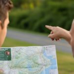
When to Go and How to Get In
Timing and access shape every trip in the Bob. Snow, fire, and distance decide what’s possible, so knowing when to go and where to enter matters more than any single route.
Seasonal Window
Snow lingers late on the passes. The real hiking season generally runs from mid-July to late September. Early July can still bring snowfields on north slopes, and late September can turn winterlike overnight.
Wildfire smoke and closures sometimes appear by August, so always check current conditions. The Forest Service maintains updated alerts for the Flathead, Helena–Lewis and Clark, and Lolo National Forests that cover sections of the Bob.
It’s also worth remembering that not every mile of trail is cleared each year. Wind events and fires can leave sections tangled with downed timber. Planning flexibility and solid navigation skills are mandatory.
Main Access Points for Experienced Hikers
Access Point
Location
Primary Use
Notes
Benchmark Road & Sun River Trailheads
East side, near Augusta
Chinese Wall and Sun River forks
Popular CDT access, long gravel approach, trail info from CDT Coalition
Spotted Bear Ranger Station
Northwest
South Fork Flathead, Great Bear access
Remote, stock-heavy routes, forest road access varies
Holland Lake & Owl Creek Packer Camp
Southwest
Holland and Gordon Pass region
Trail 35 connects to Upper Holland Lake and deeper basins
Youngs–Danaher Backcountry Access
South-central
Danaher Creek and Limestone Pass
Long approach on foot or stock; remote and quiet
Each of those entry points opens a different character of terrain. Benchmark leads toward the famous escarpment of the Chinese Wall.
Spotted Bear brings you into water-rich valleys. Holland Lake’s trailhead ties into alpine basins. Youngs–Danaher gives you the heart of the interior.
Regulations That Actually Matter
Rules in the Bob aren’t about red tape, they’re about keeping the wilderness wild. Knowing them before you go prevents fines, accidents, and ruined campsites.
Core Wilderness Rules
The Forest Service keeps an updated list of closure orders and active regulations on its Bob Marshall Wilderness Complex page. Always read the latest orders before departure.
Food Storage and Wildlife
The Bob lies inside the Northern Continental Divide Ecosystem, one of the most important grizzly strongholds in the country. Food and attractant storage rules are strict for good reason.
Carry certified bear-resistant canisters or use proper hangs where allowed. The Forest Service food storage orders outline where each rule applies.
River and Camping Regulations
If your route crosses or parallels the South Fork Flathead or its tributaries, review the Wild and Scenic Rivers regulations.
Campsite spacing, fire use, and sanitation rules are specific to the corridor. Those details are available through the Forest Service’s Wild and Scenic Rivers hub.
Safety
Safety in the Bob Marshall Wilderness depends on preparation. Grizzlies, sudden storms, wildfires, and swift rivers all demand awareness and sound judgment long before you set foot on the trail.
Bears
Grizzlies are active from spring thaw until deep autumn. You will see tracks or scat eventually. Carry bear spray and practice using it before your trip.
Make noise through dense vegetation and never store food or scented items near sleeping areas. Montana Fish, Wildlife & Parks maintains one of the most detailed bear safety resources available for the region.
Weather and Fire
Alpine weather changes without warning. Afternoon thunderstorms can turn trails into creeks. Smoke from distant fires can drift hundreds of miles.
Before you go, check current incidents on InciWeb and the Forest Service alerts page. The Bob Marshall Wilderness Foundation (BMWF) also keeps a running map of trail conditions and cleared routes.
Fords and Cold Water
Even late in summer, the Flathead forks run icy and fast. Fording requires patience. Cross early in the day when flows are typically lower. Unbuckle your hip belt, face upstream, and use trekking poles for balance.
Avoid crossing during or right after storms. The South Fork Flathead is designated Wild and Scenic, which underscores both its beauty and its hazards.
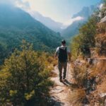
Hidden or Quieter Lines for Strong Parties
The following areas stay quieter, offering strong hikers solitude, challenge, and the kind of terrain that still feels undiscovered.
Danaher Basin and Limestone Country
The Danaher country sits deep in the interior and rarely sees casual traffic. Accessed from the Youngs–Danaher backcountry entrance north of Ovando, it unfolds into long meadow valleys, the historic Danaher Cabin, and Limestone Pass.
Many of the trails here still follow old ranger routes. You’ll encounter blowdowns, stream crossings, and long, flat sections where solitude becomes the main reward.
Holland Lake to Gordon Pass to High Lakes
Trail 35 begins near Owl Creek Packer Camp and climbs past Holland Lake into higher terrain toward Gordon Pass. The area is known for heavy stock use, which often means fewer backpackers.
The trail delivers lake views, waterfalls, and access to secondary basins that feel off-map once you leave the main corridor.
My Lake, Larch Hill Pass, and the Back Side of the Wall
View this post on Instagram
Most hikers chase the Chinese Wall, a 1,000-foot escarpment that defines the Bob’s skyline. My Lake offers an alternative. It sits near the Wall but just off the primary CDT line.
The short spur trail between Rock Creek and the Wall gives you access to alpine basins without the heavy traffic that the main route draws.
South Fork Flathead Headwaters Linkups
The Spotted Bear corridor reaches the northern interior of the Bob and the headwaters of the South Fork Flathead. The district’s trail network includes Gorge Creek, Meadow Creek, and numerous tributaries that make for creative loop potential.
Expect more horse parties than backpackers, but also immense stretches of untouched forest and cold, clear water.
Sample Itineraries for Experienced Parties
Itinerary
Days
Access
Core Segment
Why It Works
Key Checks
Danaher Basin Lollipop
4–6
Youngs–Danaher access
Lodgepole TH → Danaher Creek → Limestone Pass → return via alternate drainage
Historic cabins, deep meadows, no crowds
USFS access info, BMWF trail work map
Holland to High Lakes Circuit
3–5
Owl Creek Packer Camp
Trail 35 → Upper Holland Lake → Gordon Pass
Alpine scenery and solitude
Trail status, stock traffic
My Lake & Larch Hill Pass Loop
4–6
Benchmark or Sun River
CDT → Wall spur → Larch Hill Pass → My Lake → Rock Creek
Quieter Wall section
My Lake Trail page, Benchmark road info
South Fork Headwaters Traverse
5–7
Spotted Bear corridor
Meadow Creek and pass network feeding the South Fork
Big water and mountain contrast
Wild & Scenic rules, river fords
Fishing, Fording, and River Sense
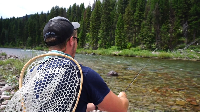
The South Fork Flathead and its forks hold westslope cutthroat trout and bull trout, both native species. Anglers must carry barbless hooks and know seasonal closures.
Even if you’re not fishing, the presence of fish means wildlife will frequent the same banks. Camp 200 feet from water sources and cook away from sleeping areas. Hang or canister all food and trash.
The river corridor belongs to the National Wild and Scenic Rivers System. Permitted activities, camping restrictions, and fire rules are outlined in the Forest Service and Rivers.gov summaries. Print them before your trip; service disappears long before you hit the first crossing.
Trail Intel Before You Pack
Even seasoned hikers misjudge the Bob without current trail data. Before packing, check what’s cleared, what’s closed, and what’s still a tangle of blowdown.
Check What’s Been Cleared
The Bob Marshall Wilderness Foundation’s interactive map shows which trails have been logged out and when.
Fresh updates often appear after volunteer projects wrap up in July and August. Knowing which sections have recent maintenance can change your itinerary by days.
Use the USFS Trail System Viewer
The Forest Service’s ArcGIS-based map tracks conditions, mileage, and access points across the complex. Download offline basemaps before the trip.
Carry Paper Maps and Compass
Helena–Lewis and Clark National Forest maps are detailed and waterproof. Electronic tools are great, but batteries fail. Bring physical redundancy.
Review the BMWF Trip-Planning Checklist
It includes essentials specific to the Bob: food storage compliance, bear safety, proper waste disposal, and emergency contact instructions.
Bears, Food, and Camps
Every hiker entering the Bob should assume bears are nearby. The most reliable prevention is strict camp hygiene:
Montana FWP’s bear resources and the Forest Service food storage orders both update yearly, so recheck them before every trip.
Access Details That Matter
- Benchmark and Sun River: Long gravel approach roads from Augusta. CDT Coalition’s site provides the most accurate directions.
- Spotted Bear: Check road conditions directly with the ranger district; snow and slides can block access until July.
- Holland Lake and Owl Creek Packer Camp: Expect stock traffic and muddy trails. Yield and communicate clearly with riders.
- Youngs–Danaher: Foot and stock only, remote, requires planning for long entry and exit times.
Quick Planning Reference
Topic
What To Check
Where To Look
Closures, orders, food rules
Active forest orders
USFS Bob Marshall page
Trail clearing status
Which routes have been logged out
BMWF trail map
River and camping rules
Wild & Scenic Rivers details
USFS and Rivers.gov
Bear safety
Regional guidance
Montana FWP bear pages
Base maps and navigation
Official maps and district contacts
Helena–Lewis and Clark NF site
Packing and Practice Notes
- Navigation redundancy: GPS, compass, and physical maps.
- Bear-smart camp routine: Canisters or proper hangs, spray at hand.
- Water crossings: Poles for balance, unbuckle hip belt, cross early.
- Contingency time: Expect blowdowns and detours.
- Footwear: Durable boots that drain and dry quickly after fords.
Plan for slower progress than the mileage suggests. The Bob is not a fast country. It rewards steady, deliberate travel.
Final Notes
@hansvanventures Oh what fun times. I miss being out there already!!!! #stopwishingstartdoing #hikingwithhannah #backpackingmeals #bobmarshallwilderness #girlsgohiking ♬ original sound – hansvanventures
The Bob Marshall Wilderness rewards discipline. The terrain is beautiful but indifferent, and success here depends on preparation.
Study the maps, read the latest Forest Service orders, check trail work reports, and plan with a margin for error. The routes listed above don’t need hype; they speak for themselves once you’re there.
For those who travel thoughtfully, the Bob offers what few places in the Lower 48 still can: silence, self-reliance, and miles of ground that remind you how much space still exists between the lines on a map.
Hello, my name is Harper Barton. The only thing I love more than travelling is writing about it. Sounds strange doesn’t it? But yeah, I adore writing and sharing my experiences about what I have experienced during my travels. Since I am a person who loves being a part of the community, I often write about local festivals with the goal of popularizing outside just small communities they come from.