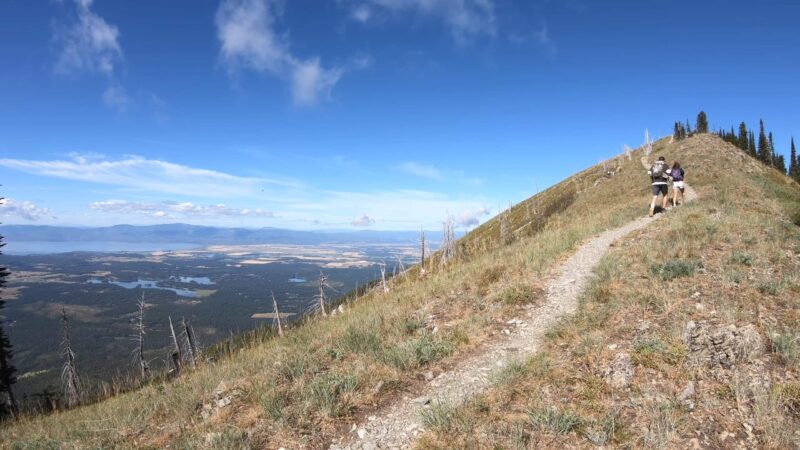
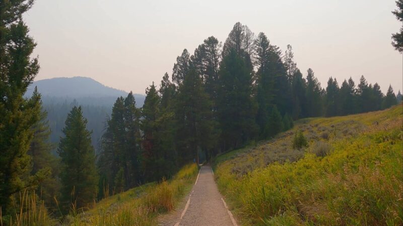
Over the years, I’ve had the pleasure of exploring many of the Flathead National Forest’s 2,400 miles of trails, each one offering a unique experience. From the high-altitude vistas of Jewel Basin to the challenging ascent of Ousel Peak to the remote expanses of the Smoky Range Trail, every hike has left me with unforgettable memories.
Today, I’m thrilled to share with you my top nine trails in Flathead National Forest. These trails, chosen based on my hiking experiences and the recommendations of fellow hikers, offer a glimpse into what you can expect to see and experience. So, if you plan a visit to this gorgeous forest, lace up your boots, pack your gear, and join me. There will be something for everyone.
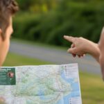
For all of our faithful readers, we’ve prepared a Free Hiking Plan for anyone looking to explore the trails of Flathead National Forest in Montana. You can download it here.
1. Jewel Basin
Jewel Basin, located east of Bigfork, Montana, is a scenic high-altitude basin with a series of lakes and several hiking trails of various lengths. The trailhead is located at the end of Forest Service Road 5392, a gravel road that climbs precariously to near the top of a ridge a few miles outside the basin. I did find that the drive up the mountain is a bit stressful, as the narrow gravel road has a lot of blind corners and no guardrails, so be extra careful!
The area is popular with locals on the weekends, so visit during the week if you want to have the place to yourself and avoid bigger crowds. Since there are so many trail branches and loops, I suggest you print out a trail map or load one onto your phone before you go. The trails are really chill and peaceful, so I suggest this one for visitors who enjoy a less crowded experience.
Why I recommend it
- Scenic high-altitude basin with a series of lakes
- Offers Glacier Park Scenery without the crowds
- A variety of trails of different lengths
- Less crowded on weekdays
2. Ousel Peak
Ousel Peak trail is not for the faint-hearted. The trail gains somewhere between 3800 and 3900 feet over 3.3 to 3.6 miles, making it one of the steepest trails in the Glacier area. The trailhead is easy to miss and starts near mile marker 159 on Highway 2, 6.5 miles east of West Glacier on Highway 2. Pay attention to the signs for the trailhead on Highway 2, since the trailhead is hidden when driving from the west.
The trail ascends the north side of Ousel Peak, and dense forest provides shade most of the way up. Early on, the trail climbs through a mature lodgepole pine forest with some cedar and hemlock. After a mile, you will notice a sign that indicates entry into the Great Bear Wilderness. At the top, a few old wires remain from a fire lookout that stood here from 1931 to 1957. I found that this trail is a bit challenging, but once you make the climb, it will be totally worth it.
Why I recommend it
- Offers a challenging hike for experienced hikers
- The dense forest provides shade most of the way up
- Beautiful views from the top
- The hidden trailhead for an adventurous start
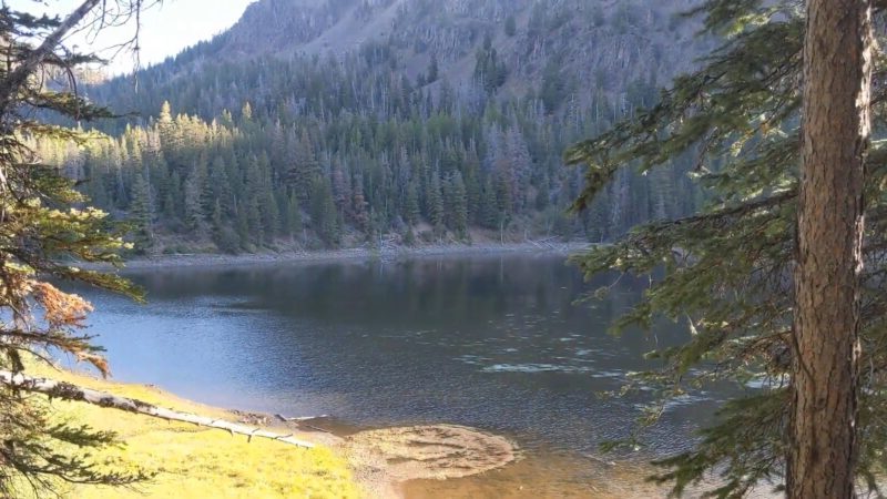
3. Stanton Lake
Stanton Lake features pristine waters and impressive mountain views after a short 2-mile hike. Most of the elevation gain is in the first half mile; then, a good trail leads to the foot of the lake. I decided to extend the hike by hiking on a trail along the west side of the lake another mile or so. I can only describe it as a Glacier Park hike but without the crowds.
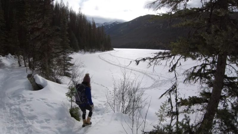
The trailhead is located on Highway 2, about 17 miles east of West Glacier, near mile marker 169. The parking area is the first driveway east of Stanton Lake Lodge. I love visiting Stanton Lake in winter since I’m a huge fan of snowshoeing, but it’s beautiful all year round.
Why I recommend it
- Short hike with impressive mountain views
- Pristine waters perfect for a mid-hike dip
- Less crowded compared to Glacier Park hikes
- Accessible for winter snowshoeing
4. Skiumah
Skiumah trail is a half-day year-round hike departing from Highway 2 that ascends to a small lake in a cozy glacial cirque and is a great introduction to the Great Bear Wilderness. I usually visit during summer, as this lets me avoid the crowds on a mostly shaded route. The trail is pretty cool in the winter as well, and it also has year-round access from a plowed highway.
The trailhead is located eleven miles east of West Glacier and is marked on the Highway. I found that the parking’s location on the North Side of Highway 2 across the road from the trailhead is pretty convenient.
Why I recommend it
- Year-round hike with a mostly shaded route
- Ascends to a small lake in a cozy glacial cirque
- A great introduction to the Great Bear Wilderness
- Accessible from a plowed highway in winter
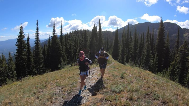
5. Smoky Range Trail and Standard Peak
Located not far from the Moss Mountain Inn, the Smoky Range Trail is a place where I got the most impressive views of Glacier National Park and the Whitefish Range. The trail starts high and skirts along the top of the Smoky Range, a series of mountain ridges north of Columbia Falls and Whitefish.
The east trailhead, near Moss Mountain Inn, was a bit tricky to find for me the first time, as there is only a small sign on the left side of the road that marks it. There is no parking lot, but you can just park in a spot where the shoulder widens out nearby. If you get to the end of the road, you missed the trailhead, so go back 1/2 mile.
Why I recommend it
- Offers impressive views of Glacier National Park and the Whitefish Range
- Travels into some very remote areas
- Starts high and skirts along the top of the Smoky Range
- Close to Moss Mountain Inn
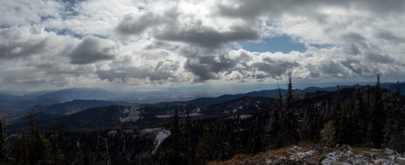
6. Firefighter Lookout
The Firefighter Lookout trail is a forest service road (38B) that climbs steadily for 4 miles up the east side of a wooded ridge to an active fire lookout. Despite the climb, I found that hiking here is easy due to the gradual grades and well-maintained road. The trailhead to Firefighter Lookout is on the west side of the road, 15 miles south of Martin City, marked by two gates – you can’t miss it.
The gate on the right leads to Firefighter Lookout and is open to vehicles after July 1. The climb starts in a mixed forest of lodgepole pine, larch, and Douglas fir, heading west, then south, then north on the way up the ridge.
Why I recommend it
- Easy hiking due to the gradual grades and well-maintained road
- Active fire lookout at the end of the trail
- Great Northern Mountain dominates the skyline to the east
- Accessible to vehicles after July 1
7. Glacier View Mountain and Demmers Ridge
Glacier View Mountain trails offer a number of options. You can hike in and out from one trailhead, drop a car off at one trailhead and hike back from another, or even do a loop around the south side of the mountain. I believe that the easiest route up Glacier View Mountain is via trail # 381 from the west off Forest Service Road 317.
The trailhead is 1/4 mile north of the junction of Forest Service Roads 316 and 317 and is easy to miss. There is no parking lot, just a sign (which is often broken off at the base) and a narrow gap between the trees alongside the road. The trail starts across an area burned in the 2001 Moose Fire and stays in the open country the whole way up.
Why I recommend it
- Plenty of hiking options, including in and out, drop-off, or loop
- There’s a very easy route up Glacier View Mountain via trail # 381 from the west
- Stays in the open country the whole way up
8. Forks Patrol Trail/Dead Horse Ridge
The Forks Patrol Trail (Glacier View District Trail 452) is an energetic climb offering great views away from the crowds of Glacier National Park. Located about 8 miles west of the Camas Entrance to Glacier National Park, take North Fork Road to the Big Creek Road # 316. Drive about 7.6 miles west on 316 and watch for the Forks Patrol Trailhead sign on the right (north) side.
The first 4 miles of trail are all uphill on a south-facing hillside, meaning it will be hot in midsummer but free of snow early and late in the season. Owing to the 2001 Moose Fire, the forest is young, so you’ll have some nice views of the surrounding mountains most of the way up.
Why I recommend it
- Vigorous climb with great views away from the crowds of Glacier National Park
- The first 4 miles of trail are all uphill on a south-facing hillside
- Nice views of the surrounding mountains most of the way up
- Accessible early and late in the season due to south-facing hillside
9. Strawberry Lake
Strawberry Lake trail, located near the Jewel Basin, is a moderate hike with a round trip distance of 5.6 miles and an elevation gain of 1500 ft. I love the fact that it is well-marked with a sign and a small parking lot. There is no toilet. After crossing a small stream (the only water on the ascent), the trail ascends at a moderate pace through a vast stand of Western Hemlock.
The trail continues to ascend the west side of the Swan Mountain Range for the next few miles via some broad switchbacks. At the top of the ridge, you’ll see that the trail descends to Strawberry Lake. The lake is beautiful and has a small island in the middle. The trail continues around the lake to Strawberry Lookout, an additional 1.5 miles.
Why I recommend it
- Moderate hike with a round-trip distance of 5.6 miles
- Ascends at a moderate pace through a vast stand of Western Hemlock
- Beautiful alpine lake with a small island in the middle
- The trail continues to Strawberry Lookout, an additional 1.5 miles
Final Words
Flathead National Forest offers different hiking trails for all levels of outdoor enthusiasts. If you’re seeking a challenging climb, a peaceful stroll by a lake, or a high-altitude adventure, you’ll find a trail that suits your needs in this expansive forest. I enjoy it whenever I visit, and I strongly recommend you give it a chance.
I’m Noel Massey, your not-so-typical trailblazer who’s been into hiking for years while herding two mini adventurers, a.k.a. my sons. We’ve tackled trails that would make your GPS do a double-take. Join me as I share tales from the great outdoors, and share some handy tips you could use in the future.