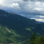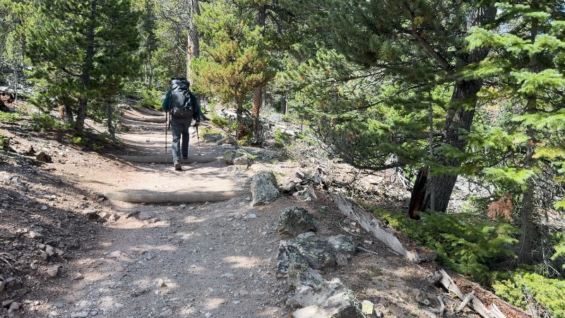
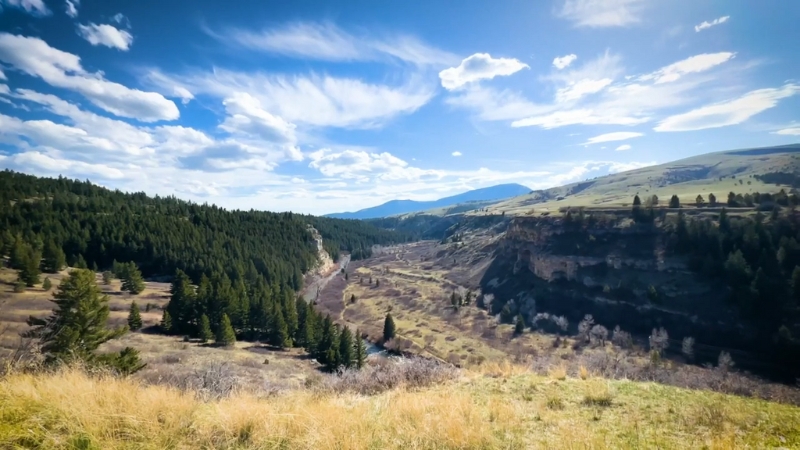
Montana’s big-name hikes are magnets for summer crowds. Residents know the art of picking routes that trade bumper-to-bumper trailheads for quiet valleys, windswept lookouts, and lakes with nothing but loons and ripples for company.
According to the National Park Service, Glacier and Yellowstone alone logged more than 3.2 million visits in 2024, part of a record 331.9 million National Park Service visits nationwide.
That crush isn’t slowing in 2025, which makes lesser-known trails more valuable than ever. With that said, we prepared a guide to quieter corners of Montana, where a little extra effort rewards you with alpine drama, wildlife encounters, and solitude.
A Quick Look
Hike
Region
Distance*
Elevation gain*
Best season
Why it stays quiet
Star Peak via Big Eddy #998
Cabinets, Kootenai NF
~9–10 mi RT
~3,900 ft
June to Oct
Big climb filters traffic
Ice Caves Loop
Big Snowies, CGNF
~12 mi loop
~2,100+ ft early
July to Sept
Central MT location and early steep grade
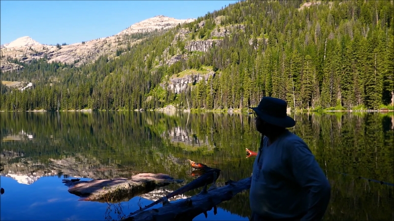
Lost Cabin Lake #150
Tobacco Roots
~8–10 mi RT
~1,400–1,600 ft
July to Oct
Rough approach road and short season
Blue Lake
Crazy Mountains, CGNF
~7–8 mi RT
~2,000 ft
July to Sept
Rocky footing and access nuances
Natural Bridges, Terry Badlands
BLM WSA
~2–3 mi RT
Minimal
Sept to May
Remote 4WD access
Sluice Boxes Canyon Trail
Little Belts, FWP
Variable
Variable
June to Oct
Unmaintained, water hazards
Glacier Lake #3
Beartooth Front, CGNF
~4.4 mi RT
~1,700 ft
July to Sept
Short, steep, high elevation
Rattlesnake NRA side gulches
Missoula, Lolo NF
Your choice
Gentle to steep
Apr to Oct
People stop in first 3 miles
Jewel Basin off-main lakes
Swan Range, Flathead NF
Your choice
Variable
July to Sept
Hiking-only area with many options
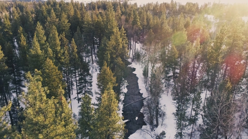
Marshall Lake (winter)
Missions, Flathead NF
~2–3 mi RT snow route
Gentle
Dec to Mar
Winter approach filters crowds
*Distances and gain are approximate; always confirm with current maps and local rangers.
1. Star Peak Lookout via Big Eddy Trail #998
Cabinet Mountains – Kootenai National Forest
Why Locals Go
A stout climb to one of Montana’s oldest lookout sites with sweeping views of the Clark Fork Valley, Scotchman Peaks, and the Cabinets. You’ll see far fewer people here than on headline hikes in national parks.
Trail Basics
From the Big Eddy Trailhead, follow Big Eddy Trail #998 to Star Peak Lookout. Expect steep grades and a full-value workout.
Local Notes
The U.S. Forest Service confirms the historic significance of the lookout and notes loop options via Star Gulch #1016 and Pilick Ridge #1036 if you want to stitch a longer day. Snow lingers early, so plan for traction in June.
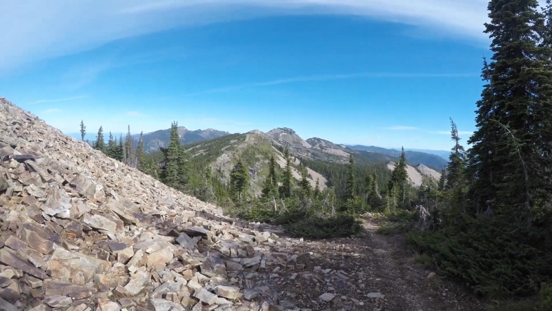
2. Big Snowy Mountains
Near Lewistown – Custer Gallatin National Forest
Why Locals Go
Central Montana solitude and a unique destination: permanent ice inside a karst cave system high on the Snowy Crest.
Trail Basics
The classic loop from Crystal Lake is roughly 12 miles with a big initial climb of more than 2,000 feet in the first few miles. Pack water and layers for the windy ridge.
Pro Tip
The ridge section is marked by cairns; visibility can drop fast in shoulder season. VisitMT’s official listing highlights route-finding and water advice.
3. Lost Cabin Lake Trail #150
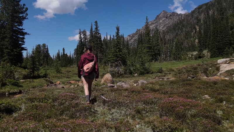
Tobacco Root Mountains – Beaverhead-Deerlodge National Forest vicinity
Why Locals Go
Craggy peaks, a high-country lake, and a strong chance of mountain goat sightings around the cirque. Far less traffic than trails closer to Bozeman or Big Sky.
Trail Basics
About 4 to 5 miles one way, starting at Bismarck Reservoir, climbing to around 9,000 feet at the lake. Best July through mid-October, depending on snow.
Heads-Up
Road approach can be rough. Early-season drifts linger in shaded timber. Regional tourism and ranger-district pages reiterate the short season window.
4. Blue Lake via Big Timber Canyon
View this post on Instagram
Crazy Mountains – Custer Gallatin National Forest
Why Locals Go
Emerald lakes tucked under dramatic limestone spires of the Crazies, with fewer hikers than park highlights to the south.
Trail Basics
Access Big Timber Canyon, then take Trail 118 to Blue Lake. Expect a rocky, moderate climb.
Access Note
The Crazies have a patchwork of public and private land. Stay on signed public easements and posted U.S. Forest Service routes.
5. Terry Badlands Wilderness Study Area
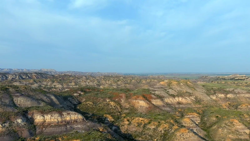
Eastern Montana – Bureau of Land Management
Why Locals Go
Badlands solitude, photogenic arches, and big-sky horizons with almost no crowds. A perfect off-season or shoulder-season wander when the high country is snowed in.
Trail Basics
The Natural Bridges path is a short out-and-back from a primitive trailhead deep in the WSA. Access often requires high-clearance 4WD along the Calypso Trail, then a signed spur to the trailhead.
Wildlife and History
BLM notes pronghorn, raptors, petrified wood, and even old military graffiti at Sheridan Butte elsewhere in the WSA. Pack plenty of water and expect zero shade.
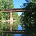
6. Sluice Boxes State Park Canyon Trail
Little Belt Mountains – Montana Fish, Wildlife & Parks
Why Locals Go
Belt Creek’s limestone canyon, mining and railroad remnants, and a primitive riverside path that feels wild while still being close to Great Falls.
Trail Basics
A rugged, unmaintained route follows old rail grade and creek banks. Expect route finding, wading in high water, and steep sidehills.
FWP warns about cold, swift water, cliffs, and terrain hazards; check the official map before committing.
Safety Update
FWP recently reminded visitors to stay bear aware after a hiker encounter in the park. Carry spray and hike in groups when possible.
It’s also smart to review your emergency supplies before setting out, since canyon conditions can change fast.
7. Glacier Lake Trail #3
@visitbillingsmt Views that stop you mid-scroll. Less than two hours from Billings to trailhead 🏔️ Time to add to your summer bucket list. 📍 Glacier Lake, Beartooth Mountains #visitbillings #beartoothmountains #hikemontana ♬ Western Music: Arizona Dreaming – Piero Piccioni
Beartooth Front near Red Lodge – Custer Gallatin National Forest
Why Locals Go
A short but steep punch to a high alpine lake perched near the state line, often with pockets of solitude once you crest above treeline.
Trail Basics
About 2.2 miles one way, with roughly 1,700 feet of gain. The trail tops above 10,000 feet before dropping to the lake, so bring layers. Fishing here spans the Montana-Wyoming line, so know license rules.
8. Rattlesnake National Recreation Area Side Valleys
Missoula Backyard – Lolo National Forest
Why Locals Go
The first few miles from the main trailhead are busy, but branch into Woods Gulch, Spring Gulch, or Ravine Creek and you’ll find the quiet corridors Missoulians cherish for after-work escapes. Maclay Flat, on the Bitterroot side of town, is another low-key walk with birds and river views.
Trail Basics
The NRA protects a large trail network with a mellow main corridor and steeper wilderness feeders. Maclay Flat Nature Trail is a flat loop suitable for families and birders.
9. Jewel Basin Hiking Area
View this post on Instagram
Swan Range above Flathead Valley – Flathead National Forest
Why Locals Go
A hiking-only zone with more than two dozen lakes and miles of trails. Even with summer popularity near Mount Aeneas, many basin lakes see light pressure, especially on shoulder days and off-peak hours.
Trail Basics
15,000-plus acres set aside exclusively for hiking and camping, 35 miles of trail, and at least 20 to 27 alpine lakes, depending on the map you check. Arrive early for parking and read the basin-specific rules.
10. Marshall Lake in the Mission Mountains
Mission Mountains Wilderness – Flathead National Forest
Why Locals Go
Short approach, big views of the Swan Range, and quiet winter beauty on skis or snowshoes when popular resort towns are crowded.
Trail Basics
Wild Montana’s current “Trail of the Week” highlights this as a roughly mile-plus snow route with a creek crossing and frequent wildlife tracks. Check wilderness regulations and seasonal closures.
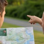
Local-Style Planning Tips
Smart planning can make the difference between a crowded trail and a day of true Montana quiet. Here are a few ways locals stack the odds in their favor.
Check Closures and Trail Work
Wilderness managers and partners post trail-clearing dates and alerts that change week to week.
For the Bob Marshall Complex, use the public trail conditions map provided by the Bob Marshall Wilderness Foundation, which aggregates U.S. Forest Service updates.
Shift Your Schedule
Park units like Glacier now see heavy midday peaks in summer. Hit trailheads at dawn or late afternoon, or pivot to adjacent national forests that share the same ranges. NPS visitation dashboards confirm the broader crowding trend.
Carry Bear Spray and Know How to Use It
Even canyon parks near towns get bear traffic. FWP’s recent advisory out of Sluice Boxes is a good reminder to keep food sealed, hike in groups, and give wildlife space.
Respect Access in Patchwork Landscapes
The Crazy Mountains mix public and private lands. Stay on signed corridors and honor posted easements to keep access open for everyone.
Water and Heat Management in the East
Badlands formations near Terry offer little shade. The BLM emphasizes carrying more water than you think you need and planning for rough roads.
Sample Itineraries
Planning a hike becomes easier when you can picture a full weekend. Here are a few sample itineraries to help spark ideas for your next Montana trip.
A Quiet Weekend from Missoula
- Day 1: Explore Rattlesnake NRA beyond the first 3 miles. Try Spring Gulch or Ravine Creek.
- Day 2: Maclay Flat dawn birdwalk, then drive to the Bitterroots for a lake ramble or Lookout dayhike depending on conditions.
Central Montana Shoulder Season
- Day 1: Ice Caves Loop from Crystal Lake on a clear day with light winds.
- Day 2: Easy recovery stroll on local Lewistown foothill trails, or drive scenic backroads toward the Missouri Breaks.
Flathead Valley Alpine Sampler
- Day 1: Jewel Basin lake-to-lake ramble off the main Mount Aeneas corridor.
- Day 2: Mission Mountains Marshall Lake snowshoe if winter, or a lower-elevation Swan Valley trail when thaw is underway.
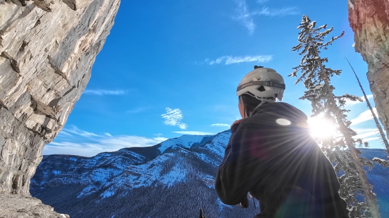
Gear and Safety Checklist for Hidden Trails
Closing Thoughts
Hidden trails aren’t just backups when marquee parks fill up; they’re stand-alone experiences in their own right.
From icy caves to badlands arches, from quiet alpine cirques to riverside paths layered with history, Montana still has plenty of places where you can breathe, stretch your legs, and feel the land without an audience.
Lace up, plan smart, and you’ll understand why locals treasure these corners of the state.
Hello, my name is Harper Barton. The only thing I love more than travelling is writing about it. Sounds strange doesn’t it? But yeah, I adore writing and sharing my experiences about what I have experienced during my travels. Since I am a person who loves being a part of the community, I often write about local festivals with the goal of popularizing outside just small communities they come from.