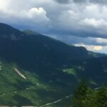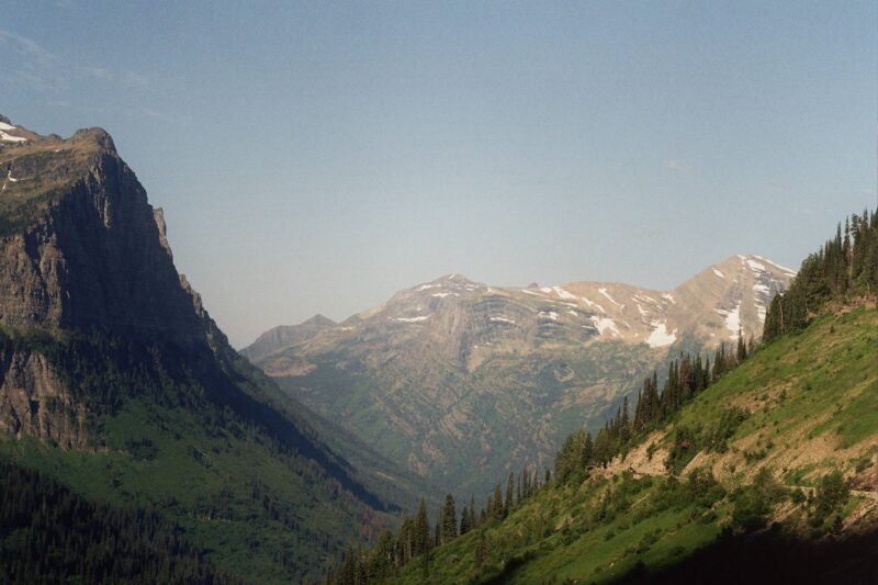
Montana holds its own in a way that feels earned, not engineered. Scenes unfold slowly, shaped by long silence and the steady hands of time.
Valleys stretch with a quiet rhythm, peaks rise like ancient thoughts frozen in form, and rivers cut their own stories through forests that seem to breathe with age.
Nothing here begs for attention, yet something about it stops you in your tracks. Across the region, what you see is the soul of the place. It moves differently, gently tugging you out of whatever rush you brought with you.
Skies seem to go on forever without apology. The ground resists being summed up in a glance. Everything feels layered with meaning, but none of it needs to be named or pointed out.
That is why the list mustn’t present a checklist or a loop of famous names.
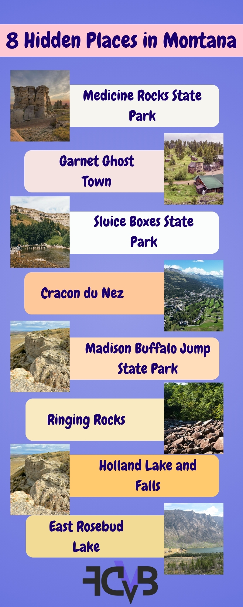
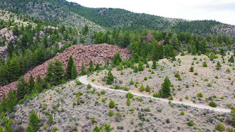
1. Medicine Rocks State Park
Out in southeastern Montana, clusters of worn sandstone rise quietly across the open plains. Shaped over millions of years by wind and rain, they feel like the earth’s own kind of sculpture.
Their surfaces, pale and timeworn, seem to shift with the light. Morning, midday, evening, it’s never the same twice.
There’s a feeling here that’s hard to pin down, like time moves more slowly and every shape holds more than just rock.
I remember standing there one morning with a thermos in hand, the air cold enough to sting a little. The light slid slowly across the rock faces, turning them gold, then white again. I pressed my palm against the sandstone and felt warmth where the sun had already touched. It was the first time in weeks I noticed silence without wanting to fill it.
Cultural and Historic Value
- Sacred to Northern Plains tribes for generations
- Petroglyphs and markings are still visible on the stone
- Even Teddy Roosevelt once called out its beauty
Best Times to Visit
Visitor Recommendations
- Take the short loop trail; most of the best spots are right along it
- Bring a notebook or sketchpad if that’s your thing, something about the place asks to be captured
- Skip the midday heat to help preserve what’s already fragile
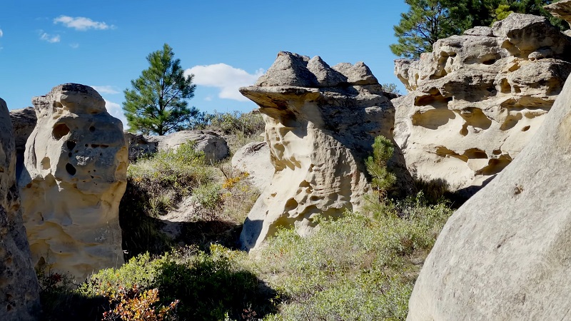
2. Garnet Ghost Town
Hidden high in western Montana’s mountains, Garnet feels like someone’s memory folded into rock.
Dozens of old buildings still stand, weathered but proud, while forest edges creep in again around the old mining camp.
Silence rules. Only the wind pulls sound through creaking boards, doors left just open enough to whisper.
I walked between the buildings and tried to imagine the noise that used to live here. The scent of pine was thick in the air, and somewhere a shutter creaked. I peeked into a general store, shelves still half-standing, dust hanging like smoke. For a moment, it felt like the place was waiting for someone to come back, maybe not me, but someone.
Travel and Access Tips
- Reachable by dirt road in summer (most vehicles will do)
- In winter, motor travel is prohibited, and snowmobile is the route
- Bring cash or a check for donations and for interpretive materials
Activities and Add-ons
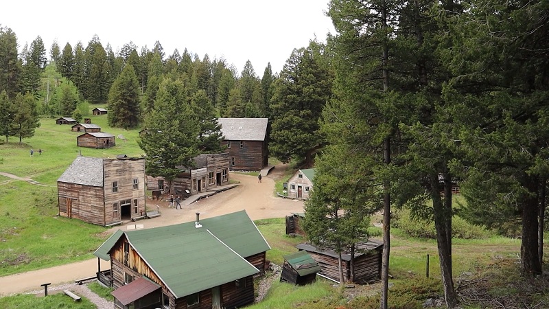
3. Sluice Boxes State Park
View this post on Instagram
Shaped over time by the push of Belt Creek, this stretch of canyon country feels both wild and storied. Cliffs tower on either side, casting long shadows over pools that run deep and still.
Scattered along the way are quiet reminders of the mining days, old cabins, bits of machinery, even parts of a narrow-gauge rail line slowly giving in to rust and roots.
I followed the trail until the creek crossed in front of me. The water was cold enough to make my feet ache. Rocks were slick, and I took my time getting across. A few rusted rails lay half-buried near the bank. The sound of running water was the only noise most of the day.
Trail Advice
- Wear solid boots, rocks, and uneven ground are constant
- Carry plenty of water; shade is rare
- Be careful crossing the creek in spring or after rain
What to Try
4. Cracon du Nez
This sharp ridge, jutting between the Missouri and Teton Rivers, creates a dramatic contrast against the surrounding plains.
Its name, meaning “snout ridge” in French, refers to the way the land pushes forward with the force of a natural rampart.
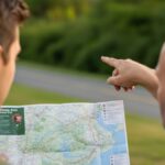
The road in was rough, and I had to stop twice to check my map. When I reached the ridge, the wind hit hard and steady.
I could see both rivers from the top, the Missouri on one side, the Teton on the other. It felt remote, quiet, and bigger than I expected. No one else was around the whole afternoon.
Noteworthy Features
A narrow ridgeline trail offers clear, wide-open views in every direction.
Looking out to the east, the Missouri River Breaks stretch across the horizon.
Below the ridge, an old rail tunnel adds a forgotten piece of history to the scene.
Travel Tips
Dry weather makes the visit safer, as wet trail surfaces can get slick. Gravel roads lead the way in, though signs are few and far between.
Cell service is almost nonexistent, so it’s best to plan routes before setting out.
Ideal Activities
Golden hour brings out the best light for long-form photography.
Walking along the ridge feels quiet and uninterrupted, a rare kind of stillness.
Nearby prairie invites more time on foot or even by bike, with space to move and think freely.
5. Madison Buffalo Jump State Park
High on a rise above the Madison River, a quiet space holds a story older than anything built by hand.
Long before roads were drawn or property lines laid down, people gathered here with purpose.
What looks now like open grass and stone once moved with life’s fast steps, shouted signals, and a shared rhythm born of survival.
For generations stretching far back, hunters worked together with incredible coordination. Large buffalo herds were guided toward the cliff’s edge by skill, strategy, and trust.
Every role mattered, runners leading the chase, decoys drawing attention, each action passed down through time and memory.
The site holds an emotional and historical depth that surpasses its visual drama.
I walked out toward the edge where the cliff drops. There isn’t much to mark the history at first glance, but when you stop, it’s easy to picture what happened here. The wind was strong, and the view stretched for miles. I stayed a few minutes without talking, just looking.
What to See
- The cliff itself, used as a buffalo jump for over 2,000 years
- Interpretive signage detailing indigenous hunting techniques
- Sweeping views of the Gallatin Valley and the surrounding mountains
Tips for Visitors
6. Ringing Rocks
In a remote section near Butte, a large boulder field hides an acoustic mystery. When struck with a hammer or small rock, many of the stones produce clear, bell-like tones.
Scientists speculate about the composition and pressure within the rocks, but no explanation can match the immediate experience of sound drawn from stone.
Planning a visit to Ringing Rocks requires preparation, especially due to the remote and rugged nature of the access road. A high-clearance vehicle is necessary, as standard cars may struggle with the rough terrain leading up to the site.
Those arriving should bring a metal hammer, which helps reveal the unusual tones by striking various rocks across the field. It is important to leave every rock exactly where it lies.
The road up was rough but manageable with a high-clearance vehicle. At the site, I used a small hammer, as others suggested. The first few rocks made dull sounds, then one rang like metal. The noise was clean and short, and it echoed a little in the air. People nearby were testing different stones too. Everyone seemed surprised each time it worked.
Bonus Tips
7. Holland Lake and Falls
@destinyhenson_ When in Montana ?️ #montana #hollandlake #traveling ♬ Take it easy demo – GoldFord
Tucked deep inside the Flathead National Forest, Holland Lake rests with a stillness that feels almost unreal.
On calm days, the surface turns mirror-like, catching every detail of the sky, tree line, and snow-dusted peaks, as if the whole world paused midbreath just to take it all in.
A clearly marked trail traces the lake’s northern edge, skimming the shoreline with uninterrupted views before gradually climbing through a quiet forest.
Pines tighten around the path, birds flicker overhead, and the sound of water grows louder with each step.
The trail followed the water most of the way. I passed a few hikers coming back, but mostly walked alone.
When the falls appeared, the sound carried before I saw them. I sat near the edge for a while, watching the spray move with the wind. The water was cold and clear enough to drink.
Trail Features
- Forest‑framed shores are great for picnics
- About three miles round trip, moderate elevation gain
- Views of the lake nearly all along the way
Visit Notes
8. East Rosebud Lake
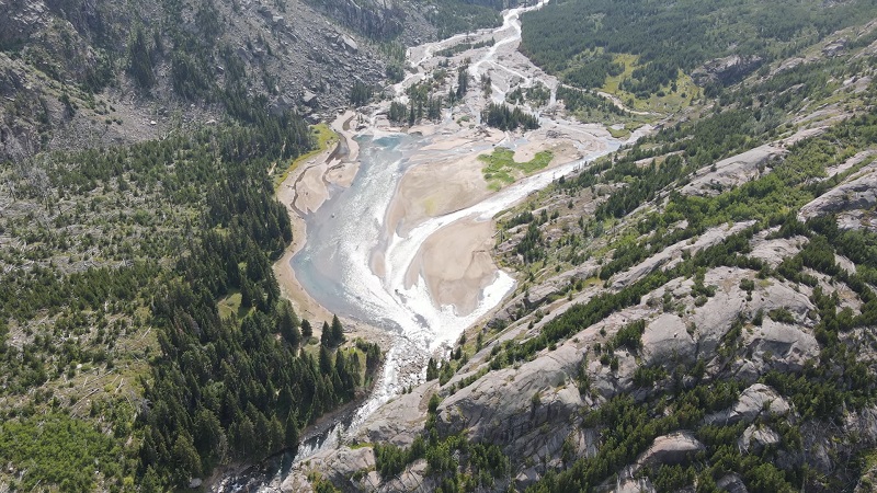
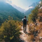
East Rosebud Lake lies in a glacial valley where snow-fed waters glint beneath soaring, jagged peaks. Access by road is possible, yet a sense of raw wilderness remains, rarely found in spots so reachable.
At first sight, its calm surface feels otherworldly: granite walls reflect with striking clarity, interrupted only by a breeze or the flicker of a passing trout. Despite the ease of access, crowds stay away, attracting those who hunger for nature unfiltered and still.
Beaten Path finds its start here, a storied twenty-six‑mile trail winding through some of the most remote reaches of the Beartooth Range.
For experienced backpackers, a full traverse links East Rosebud to Cooke City, crossing high passes, hidden tarns, and glacier‑carved valleys as though time forgot them.
I got there early, before sunrise. The lake was calm, and mist hung low over the surface. A few tents were along the shore, but no one was awake yet. I made coffee by the water and waited for the first light to hit the peaks. It stayed quiet except for the sound of a few birds across the valley.
What Sets It Apart
Mirror‑like water displays the soaring spires with almost perfect symmetry, shifting with every cloud or whisper of wind.
Trails around the lake lead into alpine meadows, concealed cascades, and quiet pools scented of pine and snowmelt.
Even nearby terrain feels untamed, a sanctuary where silence speaks more loudly than any human presence.
Best Time to Go
June through September offer the safest window for visits. In early summer, melting snow swells streams and waterfalls, while wildflowers burst across valley meadows.
By late August into September, cooler air sharpens the vistas, and golden larch needles glow against gray rock.
Human traffic thins in early autumn, leaving space for quiet reflection by shore or on trails.
Tips for Time There
Arriving at dawn brings mirror-still reflections that surrender once wind stirs across the surface.
Hiking a stretch of the Beaten Path reveals sights that feel distant from civilization: sparkling creeks, curious wildlife, and sweeping views of the Beartooth high country.
Pack a picnic or a thermos of coffee to savor by the water’s edge, and linger through the evening as the sun ignites peaks in tones of orange and red.
FAQ
Final Thoughts
Montana does not need to compete with anywhere else. It offers places that carry weight, silence, and a kind of beauty that leaves no room for distraction.
Each location in this list stands apart, not because someone made it that way, but because nature shaped it with precision and patience.
No signs, no crowds, no performance, only space, depth, and presence.
Hello, my name is Harper Barton. The only thing I love more than travelling is writing about it. Sounds strange doesn’t it? But yeah, I adore writing and sharing my experiences about what I have experienced during my travels. Since I am a person who loves being a part of the community, I often write about local festivals with the goal of popularizing outside just small communities they come from.