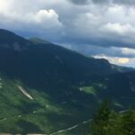
Montana earns its nickname, Big Sky Country, for good reason. Glacier-carved peaks rise sharply against the horizon, turquoise lakes glimmer beneath high walls of stone, and waterfalls stitch silver lines down sheer cliffs.
For hikers, it is a place where nearly every trail feels like it was built for views. If you are planning a trip that delivers scenery with a capital S, Montana will meet you halfway.
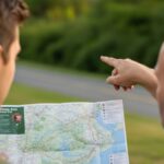
With that said, we prepared a field-style guide to the state’s most spectacular hiking routes. You’ll find a quick-look table for orientation, in-depth trail profiles, safety notes that matter in bear country, and practical logistics shaped by current National Park Service, U.S. Forest Service, and Montana Fish, Wildlife & Parks guidance.
A Quick Look
Area
Trail
Distance & Gain
Signature Landscape
Best Season
Notes
Glacier NP
Highline Trail to Grinnell Glacier Overlook
~14–15 miles out-and-back, strenuous
Exposed ledges, wildflower meadows, close-up Continental Divide
Jul–Sep
Narrow shelf sections; bear activity; check closures
Glacier NP
Grinnell Glacier
~10–11 miles, ~1,600–2,000 ft
Receding glacier, teal lakes, classic Many Glacier walls
Jul–Sep
Boat shuttle cuts mileage; frequent closures for bears
Glacier NP
Iceberg Lake
~9–10 miles, ~1,200–1,500 ft
Turquoise lake, vertical cliffs, floating ice
Jun–Sep
Very popular; carry bear spray
Glacier NP
Avalanche Lake
~4.5–6 miles round trip
Old growth cedars, milky blue lake, waterfalls
May–Oct
Crowded by mid-morning; pairs well with Trail of the Cedars
Absaroka-Beartooth Wilderness
The Beaten Path
~26 miles one way
Granite cirques, alpine lakes, waterfall steps
Jul–Sep
Point-to-point shuttle; check advisories
Kootenai NF (Libby)
Kootenai Falls & Swinging Bridge
~1.6 miles round trip
Montana’s iconic free-flowing falls, swaying bridge
Apr–Oct
Family-friendly; hot and exposed in summer
Custer Gallatin NF (Bozeman)
Hyalite Creek to Hyalite Lake
~11 miles round trip, ~1,900–2,000 ft
Waterfall corridor, cirque basin lake
Jun–Oct
Snow lingers; busy weekends
Bitterroot NF (Hamilton)
Blodgett Canyon Overlook
~3 miles round trip, ~600–700 ft
Canyon ramparts, Selway-Bitterroot vistas
Apr–Oct
Steep drop at overlook; leash pets
Flathead NF
Jewel Basin Hiking Area
3–12+ miles, variable
Dozens of alpine lakes, Swan Range views
Jul–Sep
Hiking-only zone; group size limits
Bob Marshall Wilderness
Chinese Wall
40–75+ miles, multi-day
Limestone escarpment stretching ~22 miles
Jul–Sep
Camping restrictions; remote
Glacier National Park
Glacier alone offers more than 700 miles of trails. Some of the most famous routes in the American West start here.
Trail Status and Timed-Entry Basics
Glacier requires timed vehicle reservations on the West Entrance of Going-to-the-Sun Road and on the North Fork between 7 a.m. and 3 p.m. (June 13 – September 28, 2025).
St. Mary on the east side does not require timed entry, but mid-day crowd closures can still happen. Reservations are available through Recreation.gov. Always check the Glacier NPS trail status page before setting out.
Safety in Bear Country
Hike in groups, carry bear spray where it’s instantly accessible, and make noise in brushy terrain. Glacier notes no documented attacks on groups of four or more.
Trail running is discouraged because it increases the risk of surprising wildlife. Back at camp or home, you can slow down and explore Number Artist collection, a calmer way to connect with mountain beauty.
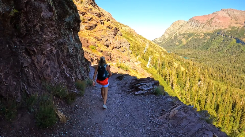
1. Highline Trail to Grinnell Glacier Overlook
View this post on Instagram
Why it’s spectacular: From Logan Pass, the trail hugs ledges with views down into the Garden Wall. Wildflowers bloom across open slopes, and the spur to the overlook reveals a sheer drop into a turquoise glacier basin.
Need-to-know: Slips on narrow sections have proven deadly. Step carefully and check for partial closures. Wind funnels along the ridges, so carry layers.
Tips
2. Grinnell Glacier
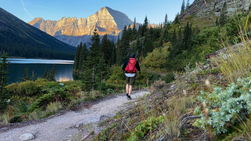
Why it’s spectacular: The Many Glacier centerpiece. A chain of teal lakes, waterfalls, and ice fields backdropped by sheer cliffs.
Distance and effort: About 10–11 miles with 1,600–2,000 feet of gain. The concession boat shuttle trims mileage if you prefer.
Seasonal notes: Upper sections usually open in mid-summer. Always check the park’s daily reports.
3. Iceberg Lake
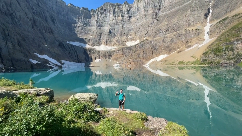
Why it’s spectacular: A turquoise bowl rimmed by vertical stone, with floating ice often lingering into August.
Distance and effort: 9–10 miles, moderate elevation gain. Allow 4.5–5 hours at a steady pace.
Planning tip: Ranger-led hikes are sometimes available. Many Glacier’s trail system has occasional construction closures, so check before you go.
4. Avalanche Lake via Trail of the Cedars
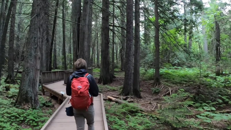
Why it’s spectacular: A short forest walk leads to a milky blue lake framed by cliffs and cascading falls.
Distance and effort: About 4.5–6 miles, gentle grade.
Timing tip: Arrive early or late in the day to avoid crowds. This one is popular with families.
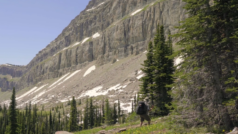
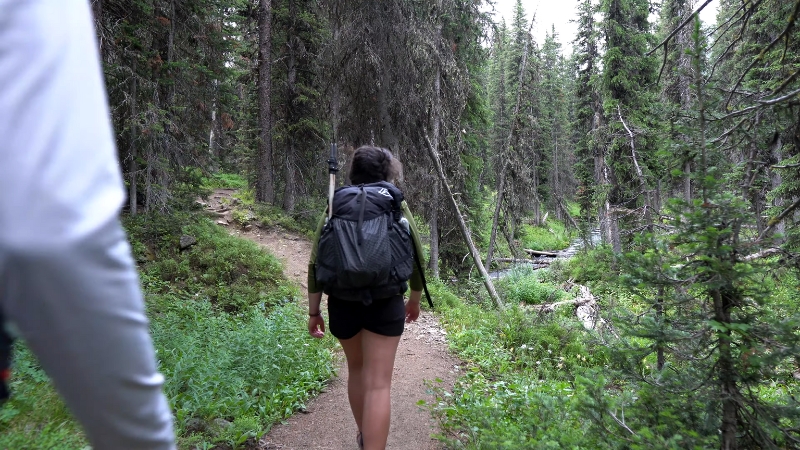
5. Absaroka-Beartooth Wilderness
Why it’s spectacular: A 26-mile traverse across high granite plateaus dotted with alpine lakes and flower meadows. Considered one of the most photogenic multi-day hikes in Montana.
Route facts: Typically done point-to-point between East Rosebud and Clarks Fork. Many start near Red Lodge and finish closer to Cooke City.
Planning Tips
Always consult the USFS Beartooth District updates for advisories before heading out.
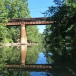
6. Kootenai Falls & Swinging Bridge
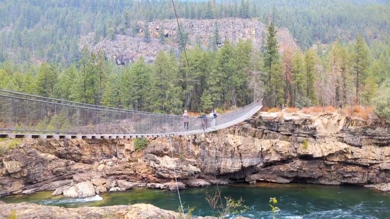
Why it’s spectacular: A short, accessible hike to one of Montana’s largest free-flowing waterfall systems. The suspension bridge offers dramatic photo opportunities.
Trail facts: About 1.6 miles round trip with minimal elevation gain.
Good to know: Summer heat makes the trail feel exposed. Keep children close to the stairs and on the bridge.
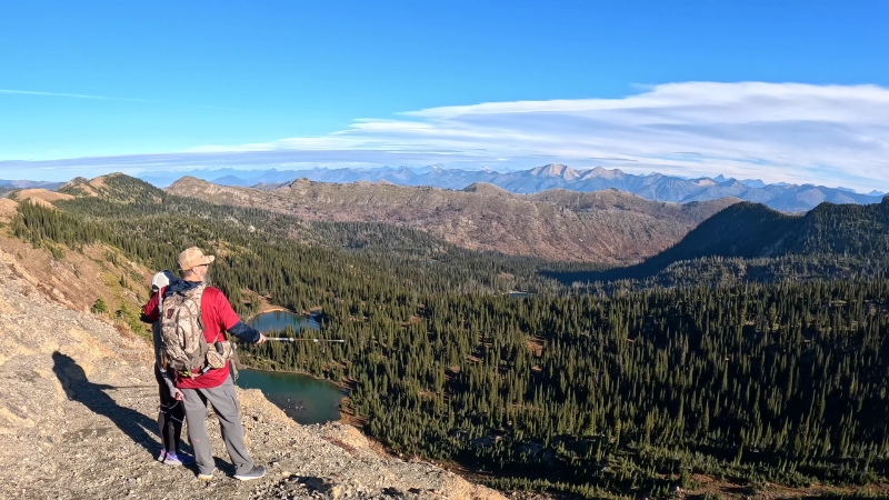
7. Hyalite Creek to Hyalite Lake (Bozeman Area)
Why it’s spectacular: A waterfall corridor leading to a high cirque lake beneath Hyalite Peak.
Distance and effort: Around 11 miles round trip, 1,900–2,000 feet of gain.
Timing tip: Snow lingers well into June. Weekends can be crowded, so we advise you to pick midweek mornings for quieter access.
8. Blodgett Canyon Overlook (Bitterroot Valley)
@aarongreenberg Blodgett Canyon Overlook, Montana (Bitterroot Valley). #fyp #foryoupage #montana #406 #nature #outdoors #adventure #socialdistancing #montanacheck ♬ Fantasy – Alina Baraz / Galimatias
Why it’s spectacular: Granite cliffs and sweeping U-shaped canyon views. A quick but rewarding outing.
Distance and logistics: 3 miles round trip, ~600–700 feet of gain. Leash pets and keep children safe near the overlook’s edge.
9. Jewel Basin Hiking Area (Flathead National Forest)
Why it’s spectacular: A 15,000-acre playground with dozens of alpine lakes and miles of interconnected trails.
Rules and scope: Hiking only. Group size limits apply, and dogs must be leashed.
Trip ideas: From Camp Misery trailhead, you can link lake-to-lake rambles or climb steeper ridges for views across the Swan Range.
10. The Chinese Wall, Bob Marshall Wilderness Complex
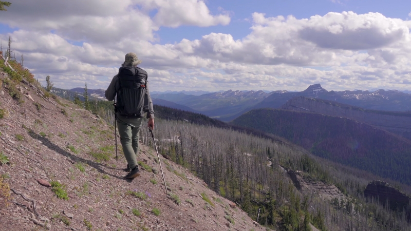
Why it’s spectacular: A thousand-foot limestone escarpment running for 22 miles along the Continental Divide. It’s one of Montana’s signature wilderness features.
Route concept: Many hikers access from Benchmark Trailhead, tying into the Continental Divide Trail. Expect multi-day routes.
Restrictions: Camping and grazing are restricted beneath sections of the wall through 2030 under a standing Forest Order. Study it before you go.
Geology note: The wall is made of Cambrian limestone, sculpted by glaciers during the last Ice Age.
Practical Logistics
Before you lace up, a few logistics can make or break your Montana hike. Timed entries, trail status, and bear safety are worth knowing.
Timed Entry and Reservations
- Glacier NP requires timed reservations for certain corridors (June 13 – September 28, 2025).
- Book on Recreation.gov in advance.
Trail Status
- Snow often lingers into July on higher passes.
- Check daily updates for closures from wildlife activity, washouts, or snow bridges.
Bear Safety
- Carry bear spray and practice unclipping the safety tab.
- Make noise, especially in thick brush.
- Hike in groups whenever possible.
Crowd-Smart Planning
- Start early.
- Visit on weekdays.
- Aim for shoulder seasons when trails are quieter.
Sample Itineraries
View this post on Instagram
- One big Glacier day: Choose between Iceberg Lake or Grinnell Glacier. If you pick Grinnell, consider the boat shuttle.
- Weekend in the Bitterroot: Hike Blodgett Canyon Overlook in the morning, then cool off with a swim at Lake Como.
- Family-friendly: Spend an afternoon at Kootenai Falls and the Swinging Bridge. Short walk, massive views.
- Ambitious multi-day: Pick between the granite cirques of The Beaten Path or the limestone drama of the Chinese Wall. Both demand preparation and respect for wilderness rules.
Gear and Safety Checklist
Responsible Travel Notes
Montana’s outdoor economy depends on visitor choices. In 2024, tourists spent nearly five billion dollars statewide, supporting more than 38,000 jobs, according to the University of Montana.
Lodging, guide services, shuttle drivers, and even search-and-rescue teams rely on that flow. Support local when you can, tip generously, and follow Leave No Trace principles.
Final Words
Hiking in Montana is about giving yourself time. Time to reach a glacier overlook, time to stand on a bridge above a roaring river, time to sit still when the canyon finally opens.
Pick one marquee Glacier trail, one national forest gem, and a short-but-sweet option like Kootenai Falls, and you’ll return with a memory card full of mountain drama.
Start early, carry bear spray, and let yourself breathe when the big view arrives. That quiet moment is the reward every hiker comes for.
Hello, my name is Harper Barton. The only thing I love more than travelling is writing about it. Sounds strange doesn’t it? But yeah, I adore writing and sharing my experiences about what I have experienced during my travels. Since I am a person who loves being a part of the community, I often write about local festivals with the goal of popularizing outside just small communities they come from.